Lebanon - Destruction of a country, by air, sea and land
 You simply MUST see this map of the destruction nationwide in Lebanon - this is officially constructed by the Lebanese Government, but is pre-Qana, 24th July. (Click on map to zoom)
... and our President and Prime Minister's hands drip with their blood.
As of 1.00 am local time Lebanon this map is meaningless as the IDF have launched a massive aerial and land strike,
Agonist lists these sites for more information ...
* http://www.lebanonupdates.blogspot.com/
* http://www.beirutlive.blogspot.com/
* http://frombeirutwithlove.blogspot.com/
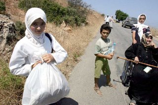
The pic is from a sequence on Der Spiegel Online here I call this Nabka II

No comments:
Post a Comment